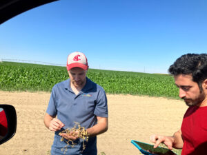
With support from a CSANR BIOAg grant, Amin Norouzi Kandelati improved a machine-learning framework combining satellite imagery, roadside field observations, crop-group, and other information to develop tillage mapping across eastern Washington.
How fields are tilled—from intensive soil disturbance to no-till management—can affect erosion and soil carbon. Knowing where different practices are used can help farmers, researchers, and conservation organizations track regional trends and, eventually, estimate their effects across the landscape, including the potential to quantify and monetize benefits in ways that return value to farmers. But eastern Washington contains far more fields than researchers could realistically inspect in person. Satellite-based tillage mapping can help fill that gap by combining observations from a sample of fields with satellite imagery and machine-learning models.