Team
- Faculty: Samarth Swarup (UVA), Abhijin Adiga (UVA)
- Undergraduate students: Andrew Ma (UVA), Christopher Goodhart (UVA)
Objective
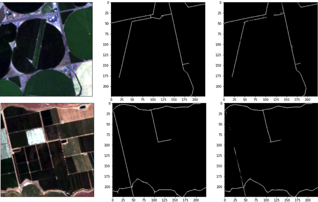
- To develop a deep learning method that extracts canals and waterways from remote sensing images. After extracting waterways from images, map the waterways. With a map of all waterways in the area, determine what waterway each farm/field draws from, and at which specific point the water is drawn. This would help agricultural management determine how to use water more effectively, which is especially useful in times of water shortages and droughts.
Approach
We explored the usage of the ResUNet deep learning architecture to tackle the segmentation of waterways. ResUNet was chosen due to its strong performance in road extraction from remote sensing imagery, a task that is quite similar to waterway extraction. The data used to train the models consisted of processed imagery from RapidEye satellites as input, and a mapping of waterway data onto a grayscale image as output. The model was then trained on 224 x 224 sized patches extracted from the image.